This year, is the year of re-inventions for UCD, not only fancy openings or capital increases. New friends helped us to re-invent ourselves, to push our limits further and further in order to face
all the possibilities we have and all the actual problems that Todays tech can come up with.
Reaching the end of this year, we are looking back at an astonishing summary! Dozens of Academical institutes trusted us for their UAS Explorations, High standard and risk industries merged us to their everyday procedures, even our turtle moving cadastral considered and used our services!
But the fairest of them all, that really worth’s to mention, is the compendium of Dull Dirty and Dangerous! We believed in renewable energy, and the people that struggling to place these state of the Art machines, either solar or wind at unreachable places embraced that trust.
Renewable energy has a new ally… Unmanned Systems as a powerful tool to reach the unreachable and efficiently place these Rotary Giants to harvest clean energy for as…
The Project:
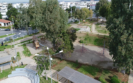
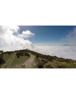
The purpose of this project, was to precisely survey a sierra Mountain (Epirus, Greece) for a Wind Turbine Park installation Study. The magnitude of the study area and the unapproachable terrain made it a real challenge for the sUAS tier.
Using a proven airframe and pushing the efficiencies to the limit we managed to conduct the largest Aerial Mapping mission, with a sub 3m wing span – 4kg airframe ever done!
I hope this partnership of trust will trigger more pioneering feats between scholars, entrepreneurs and UAS Constructors-Designers.”