Authors: Helen Vassiliou, Dr., PhD Archaeoastronomy University of The Aegean and Dimitrios Stefanakis, PhD candidate, Dpt of Environment, University of the Aegean
Abstract: Mapping of the Christian Churches in Medieval City of Rhodes Island. A new perspective of the orientation with the use of a Remote Sensing Unmanned Aerial System (UAS).
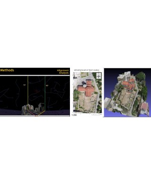
The goal of this work is the development of a modern 3D map of the Christian Churches in the Medieval City of Rhodes Island, indicating and depicting the intention of their eastern alignments.
The innovative tool is the use of an Unmanned Aerial System (UAS) that carries sensors and cameras flying over (about 150m.) the study area transmitting real time alignments data (i.e. Azimuth of the main axis of the building, angular altitude of the visible horizon, geomorphologic information, atmospheric refration), that has been programmed to collect. The collected data combined with GIS computational routines and several sky simulator applications such us SkyMap and StarryNight, give us the result of a detailed 3D depiction of the alignment of every single monument in relation with one another in the Medieval City.


