

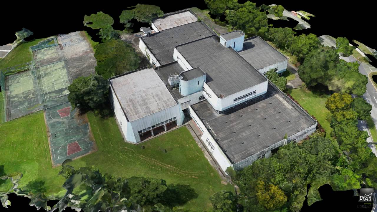
Topographic applications Aerial photography Property projection Overview applications in urban web BIM Integrated Services (Building Information Modelling) Custom Built UAS, adapted to specific needs and training in the use of Our High expertise and know-how plus our advanced equipment allow us to record up to 100 km2 / flight, when the average is at 1-2 km2 / flight, which is up to 100 times higher than usual. Our aerial recording and data collection using UAS, gives us the ability to survey even the most inaccessible areas, with high standards of security, speed and accuracy. Spatial 3D representation in digital form, based on the principles of photogrammetry, is a very important factor in industrial applications, especially in the comparative mapping of buildings and installations. Any construction or modification of an industrial plant is made easier, with less cost and less time, when it has been spatially digitized. Τhis representation is based on the principles of photogrammetry. Sequential aero photo shooting, with specific overlays and features, is processed by specialized software and then processed by photogrammetric procedures. Immediately afterwards, 3D calculations of the terrain are extracted at: DTM – Digital Terrain Model Using 4K resolution video recording gives us the best picture quality we can have today. This resolution varies from 3840×2160 to 4096×3112 pixels, that is, more than double the corresponding full HD image quality, with very accurate detail recording and real-time ground inspection. In real estate appraisal applications, 3D models and topographic charts of real estate are displayed and by using Virtual Reality the interested person can navigate throughout its property via a computer. The amount of information about the property can even be greater, as the collection of images through specialized topographic software, creates three dimensional point cloud and digital terrain models, which throughaerotriangulation method,surface model are analysed or even further extraction of high resolutionorthophotos and creation maps in Google Earth or GIS. Integrated troubleshooting services for confronting problems that are complex, time-consuming or economically unprofitable to manage, by using conventional methods such as: Recording maps of residential lighting / lighting chatUAS Topographic applications
& Real Estate promotion services
Advantages
Compared to conventional methods
Ability to capture large areas and inaccessible territory
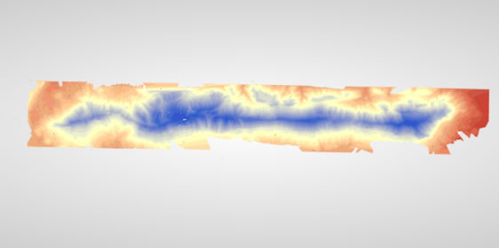
3D illustration
DSM – Digital Surface Model
DEM – Digital Elevation Model
Afterwards , after being geometrically corrected, they obtain geodetic coordinates in the Greek Reference System, and the results are displayed on high-precision orthophotos and 3D digital models4K resolution recording video
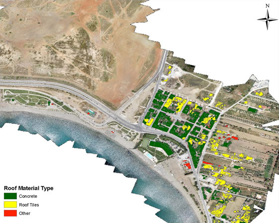
Presentation of properties
Residential Web Applications
Problem solving of Municipalities
Pillar registration (water abstraction, electricity lines etc) of Municipalities
Direct, accurate measurement of the coverage of bank seats and other rental spaces of the Municipalities
Directly correlate the collected information with the Geosciences of Technical Services
Immediate analysis and correlation of data in Geographic Information Systems
Maintenance analysis of green spaces
Noise pollution studies
Micro-climatic analysis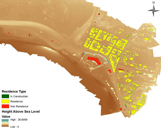
Do you have any queries? CONTACT US TODAY!