

Cultivation management based on real needs
Cultivation management based on real needs. Rational and more efficient use of water, fertilizers and pesticides. Dealing with super-pollution or malnutrition. Local controlled irrigation Soil protection, groundwater and the environment in general
Cultivation yield
Cultivation yield Precise estimation of crop yield. Optimization of harvest and increase of production efficiency
Disease treatment
Disease prevention, detection and mitigation
Monitoring and recording
moisture, pests, weed spread, outbreaks, soil erosion
Ιnteroperable files
Ιnteroperable overview files
Recording
Recording of crops and livestock
Cheaper
Cheaper recording costs
Information
Complete, accurate and detailed information
Χημικές εισροές
Ορθολογική και αποτελεσματικότερη χρήση των χημικών εισροών
Harvest optimization
Harvest optimization
Increase crop yield
Increase crop yield
Soil and ground water protection
Soil and ground water protection
Manage quality systems
Ability to manage quality systems since all data is recorded
Ensuring certifications
Ensuring certifications and Improving product quality
UCANDRONE and Precision Agriculture
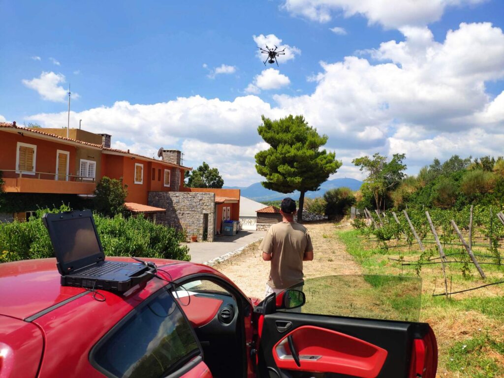
We are the first in the world to use the technology of unmanned aerial systems, remote sensing and Geographic Information Systems (GIS) in applications of Precision Agriculture, not only in recording and review, but also in the field of forecasting.
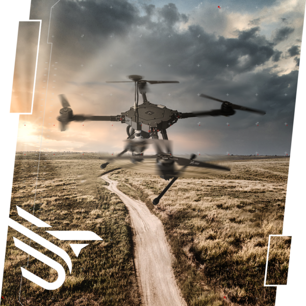
We have designed and created our own special platforms that meet the needs and requirements of the Greek environment (intense relief, climate differences, fragmented properties). Ucandrone’s UAS, are small, flexible, unmanned aerial vehicles, equipped with the most advanced payload in cameras and sensors, suitable for businesses in the field of precision agriculture, which compared to other available platforms (satellites, manned aircraft, geo-traction, tractors) can offer: Unlimited periodicity of data retrieval, no cloud cover problems, high spatial resolution at incomparably low cost of use or acquisition, capability of data processing in the field. UCANDRONE UAS platforms are available for purchase or rental with full technical support and training bycompany’s personell.
Such as manned flights or satellites, UCANDRONE’s unmanned systems do nothing more than capture the reflection of light. However, UAS spatial information obtained by UAS, differs qualitatively, since the light does not need to travel such a large part of the atmosphere and precisely because of their ability to fly low, the spatial analysis they give us, allows us to distinguish up to 2 centimeters instead of 30 meters! This ultra-high resolution allows us to have a better analysis of foliage in small plants in fragmented properties, locating in small clusters, where it is not possible to access otherwise.
Using UCANDRONE’s platforms and simultaneous use of Remote Sensing and GIS systems, we turn the “point” into a “spatial” level, thus making it possible to use the results in both ways, displaying them in space and time, concepts perfectly intertwined with agriculture and the environment.
In this way we can achieve greater speed and accuracy of mapping data, make it easier to interpret them, ensure multi-criteria analysis, select the target of impact and exclusion zones, and optimize the production result.
With continuous recording and modeling, it is possible to reverse overfertilization for the benefit of existing crops, both in quality and quantity. Thus, farmers can use every available resource and return to active production without the need for state subsidies and with results according to the latest certification standards.
Τα δεδομένα που παράγει η πλατφόρμα μπορούν να αποτελέσουν ένα ολοκληρωμένο σύστημα διαχείρισης, που για να τα αποκτήσει κάποιος αυτή τη στιγμή, πρέπει να συνεργαστεί με πάνω από 4 διαφορετικούς επιστήμονες-επαγγελματίες. Έτσι ένας καλλιεργητής μπορεί να έχει σε ένα μόνο «πακέτο» πολλές διαφορετικές υπηρεσίες ταυτόχρονα, όπως για παράδειγμα: αναφορά ή χάρτη για τις ανάγκες της λίπανσης κάθε φυτού, για την πρόοδο και την προσδοκώμενη ποιότητα της παραγωγής, προτάσεις για την επίτευξη πιστοποιημένης παραγωγής και ποιότητας στα πλαίσια της GAP, τοπογραφικό διάγραμμα με συντεταγμένες συμβατές με το Εθνικό Κτηματολόγιο και άλλες δημόσιες υπηρεσίες.
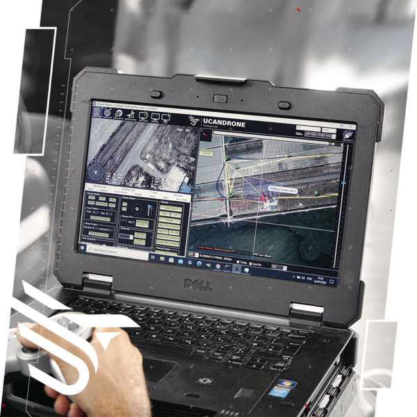
The most important advantage of Ucandrone UAS in precision Agriculture, in the context of ensuring a complete management system, is the flexibility and interoperability of the delivery material and data of the system, ie its ability to connect and operate without interruptionwith other compatible systems. Lower cost of information Flight costs are insignificant and all that is required,is the physical presence of the aircraft, in contrast to the very high cost of aerial photography with a manned aircraft carrier.Compared to satellite imagery, the image produced by UAS is of a much higher resolution, without the problem of cloud cover and can be repeated at any time we want, at the point where we want. Use of open source software. With open source software, UCANDRONE platforms are flexible, scalable, and easily adaptable to any other need.
FIELD
SURVEY
REAL TIME MONITORING
& POST INSPECTION
THERMAL & RGB
INSPECTION
4K video recording video
Using 4K video recording the outcome provides us with the best image quality we can have today.
This resolution varies from 3840×2160 to 4096×3112 pixels, which is more than double the corresponding full HD image quality, with the ability to record details with great accuracy and real-time inspection from the ground.
Three-dimensional display
Spatial three-dimensional display in digitized form, based on the principles of photogrammetry, is a very important factor in industrial applications, especially in the comparative mapping of buildings and installations.
Any construction or modification of an industrial installation is easier, at a lower cost and less time, when it is rendered spatially in digitized form.
This imaging is based on the principles of photogrammetry.
Successive photo shooting, with specific overlays and features, are processed by special software with photogrammetric procedures.
Immediately after, by applying arithmetic calculations, three-dimensional representations of the soil are extracted in:
DTM – Digital Terrain Model
DSM – Digital Surface Model
DEM – Digital Elevation Model
Then, after being corrected geometrically (geo-reference), they acquire geodetic coordinates in the Greek Reference System, while the results are depicted in high-precision orthophoto maps and in 3D digital models
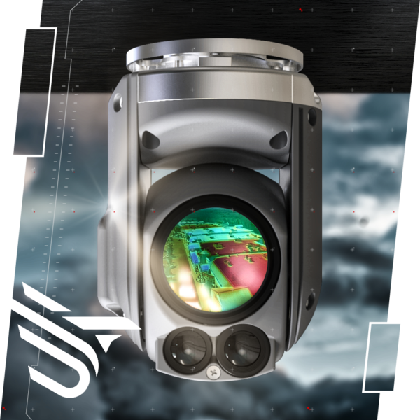
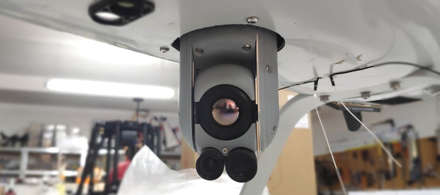
Ability to focus - standalone camera handling
The main advantage is the abilityto focus (zoom) in both options of the spectrum but also independent movement of the camera on both axes.
So the inspector is able to focus where he wish during the flight, with the help of a switch but also to turn the camera as he wishes in any direction with a separate controller, regardless of the movement and position of the used drone.
chat